A Planning Inspector has announced his Decision to allow the developer’s Appeal against Cornwall Council, with costs.
Dated 27 November 2023
“PA22/00218 – Cert of Lawfulness existing: rear extension, studio, outbuilding, garage, plant and store room and solar array – Carne Cottage, Zennor – Appeal Allowed. Costs claim against Council – Allowed.”
This provides a certificate of lawful use. It means that the permitted development does not require planning permission as it is deemed lawful. There will be none of the usual safeguards and conditions that go with planning permission such as design and materials, requirement for a survey of the site and its ancient fabric, the old historic building, the surrounding hedges, the wildlife and the archaeology. It does not have to comply with planning related policies such as Dark Skies.
It should also be noted that the trackway which provides access is subject to an easement across land owned by others. This is not a planning matter but any changes will also be detrimental to the landscape.
This is devastating news for all those who love Zennor and its precious landscape and sets an alarming precedent for the future. Any legal challenge must be made in 6 weeks ie 8 January 2024. Local residents are urged to write to their MP.
Background and Content
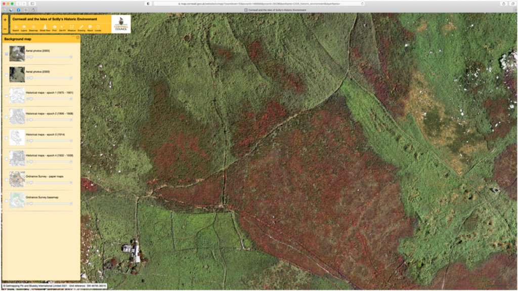
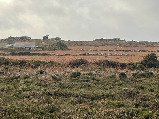
The Carne is located within the Penwith Moors above Zennor village. This derelict cottage sits in an ancient landscape with scheduled monuments such as Zennor Quoit and Sperris Quoit, with many ancient monuments and bronze age field patterns. The cottage was once part of a tiny hamlet of dwellings occupied by miners and farmers, and the whole landscape is scattered with evidence of their occupation, and evidence of life in the early industrial ages with mineral mining, alongside farming.
In the twentieth century, Carne was the permanent home of artist Bryan Wynter and his family. As a professional artist he built a wooden studio. After the Wynters left in 1964, it became a holiday home for the Meckleberghe family, also a professional artist using the studio initially. From the 1980s the Carne was seldom used, fell into disrepair and ongoing collapse. Finally Carne was sold in 2018/9 to Malcom James, a developer from Scotland, for his daughter Enya James.
It is a precious fragile landscape with majestic rock formations and tors. The Moors are confirmed as an Area of Outstanding Natural Beauty (AONB), designated A Site of Special Scientific Interest (SSSI), registered with Countryside and Rights of Way (CROW). In addition, large sections are registered Common Land and covenanted to the National Trust. It is surrounded by responsible landowners and neighbours (including the National Trust). The open landscape is enjoyed by walkers and generations of visitors and has been referenced by many writers such as WH Hudson and Michael Morpurgo, and artists such as Barbara Hepworth and Patrick Heron.
There is no vehicular access to the moors, and access to the Carne is via a rough track on land owned by others. It is open to the public and frequently used by walkers, horse-riders as well as adjacent landowners. In 2008 the owner of the Carne attempted to clear the track using a JCB doing damage to the ground and vegetation. This was stopped by the landowners. A court case followed in which the right of access for the Carne was confirmed but with the proviso that they “ .. can have no right to change the character of the way ..” and the Recorder firmly advised “ .. that repairs will be limited to nothing but local and natural materials are ever put down to fill in the ruts, potholes etc in the track.” This right of access for the Carne is limited by the Court Order in 2010 to the track width of 2 metres and 2.1 metres in openings in stone hedges.
The developer applied for Pre-Application planning advice in 2020, which revealed an ambitious grandiose design (including an underground triple garage). The Planners provided full and helpful advice for a planning application. This was ignored. The developer proceeded instead to seek to prove the Carne was not abandoned and was in continuous use as a dwelling in 2021. This was approved despite widespread opposition supported by local evidence.
The next step was an application in 2022 for effectively permitted development rights for this dwelling. It was refused by Cornwall Council, and the developer appealed. The Appeal Inspector has made his Decision to allow the developer’s Appeal against Cornwall Council, with costs. Any legal challenge must be made within 6 weeks of the decision date of 27 November ie before 8 January. There is an error and misleading information in the Decision.
At all stages there has been substantial local opposition, fearing the damage that this development will cause to the moors and their archaeology, fearing the undermining of all reasonable measures to protect the fragile landscape, and most particularly fearing the precedent it sets for the future, and the extension of permitted development rights.
These planning stages including documentation are available on the Cornwall Council website https://www.cornwall.gov.uk/planning-and-building-control/planning-applications/online-planning-register/ as follows:
2020
PA20/01439/PREAPP Pre application advice for the restoration, renovation and extension of Carne Cottage for use as a family home. Reinstatement of existing vehicular access track-way from the main road.
2021
PA21/00388 Certificate of Lawfulness of an Existing Use to certify the continuing lawful use of Carne Cottage as a private dwelling within use class C3.
2022
PA22/00218 – Certificate of lawfulness for the proposed development of: an extension to the rear of the dwelling; an art studio/home office/home gym; an outbuilding; a double garage, plant and store room; and a solar PV array.
Access Implications:
The Carne has the right of access across land they do not own – it is an easement. This right is limited by the Order in 2010 to the track width of 2 metres and 2.1 metres openings in stone hedges.
In other words the developer cannot bring in hardcore, tarmac or similar to surface the rough track. It follows that they cannot excavate the ground to put in drainage, make passing bays, or a splay at either end. This track crosses land that is AONB, SSSI designated, Nat Trust covenanted, registered Common Land and listed with Rights to Roam – CROW. The existing track-way provides access for other landowners, for use by horse-riders and for use as a footpath with access for walkers and people wishing to access Ancient and Scheduled monuments such as Zennor Quoit. The track is shared and a change of use cannot be allowed to harm the ‘character of the way’.
The Appeal decision leads to many questions that are unresolved. How will the developer and his contractors access their site without changing the character of the way? How will future occupants access the site without doing permanent harm to the land? How will Dark Skies be maintained? How will the landscape and its wildlife, be protected and how will the precious archaeology be preserved, including that on the site itself? What safeguards are there for this precious historic landscape, for future generations?
The access track is from the B3306 to the north of the site, also known as the West Cornwall Coast Road, and it is a major road of southwestern Cornwall. It connects St Ives in the east to St Just in the west. It is a renowned and much publicised scenic route.


